Easy
No reports
Distance3 kmone way
Elevation gain+150
Time3 h
SeasonMar–Nov
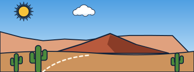
A walk between red cliffs and sandstone formations in one of Talampaya's side canyons.
The summer heat is extreme. Bring lots of water and a hat.
Talampaya National Park, La Rioja
A walk between red cliffs and sandstone formations in one of Talampaya's side canyons.
The summer heat is extreme. Bring lots of water and a hat.
Approximate location. When someone uploads their GPX track, the route will be drawn here.
It updates itself every hour. It's for the trail's map point, at the elevation shown above: higher up it's colder (about 6 °C less per 1,000 m) and windier. Gusts over 70 km/h are highlighted. Before you go, check with park rangers. Data: Open-Meteo.com (CC BY 4.0).
This is a day hike: there's no hut along the way.
We'll soon add places to stay in this area.
Round-trip distances and elevation gain are approximate. Before you go, check with park rangers or the local information office.