
Santa Cruz · 49.3°S · Easy

Laguna Torre

El Chaltén

Easy
No reports
Distance9 kmone way
Elevation gain+300
Time6 h
SeasonOct–Apr

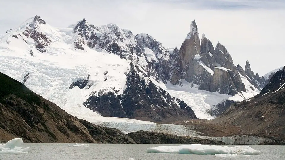
A friendly walk up the Fitz Roy River valley to the glacial lake facing Cerro Torre, when the clouds allow.

The Patagonian wind is the real challenge. Bring a windbreaker even if the sun is out.

Path (≈ 8.9 km on the map)▶StartHut or campsite (tap it to see the name)
Path calculated on OpenStreetMap trails: it's a guide, always follow the trail markings and the official map. © OpenStreetMap contributors (ODbL), routes calculated with BRouter ↗

7-day forecast

It updates itself every hour. It's for the trail's map point, at the elevation shown above: higher up it's colder (about 6 °C less per 1,000 m) and windier. Gusts over 70 km/h are highlighted. Before you go, check with park rangers. Data: Open-Meteo.com (CC BY 4.0).

Mountain huts

There are no huts: the De Agostini campsite is next to the lake. Check the rules at the visitor center.

Where to stay in the area

  • Rancho Grande HostelHostel · budget · El Chaltén

    Common areas where it's easy to meet trail partners.

    See on Booking ↗
  • Chaltén Suites HotelHotel · mid-range · El Chaltén

    Comfortable, with breakfast so you can head out early.

    See on Booking ↗
  • Destino Sur Hotel & Spa de MontañaHotel · upscale · El Chaltén

    A spa to recover after long treks.

    See on Booking ↗

Chosen for location and reviews. Source: Nomadic Samuel: where to stay in El Chaltén ↗

Round-trip distances and elevation gain are approximate. Before you go, check with park rangers or the local information office.